SHAPING THE

UAV

FUTURE

Follow Us

- Our Company

At ACCELIGENCE Ltd. we specialise on the design , development, system integration and verification of custom-made robotic solutions, with a particular focus on Unmanned Aerial Vehicles (UAVs). All our UAV models are manufactured at our branch in Athens, Greece.

With a clear orientation on innovation, our vision is based on the commitment to the most advanced technology. We are building from scratch our own UAV prototypes leveraging on-board processing capabilities to execute at the edge computationally intensive applications, tailored to the most demanding cases and sector needs.

ΜΕΕΤ ΤΗΕ ΤΕΑΜ

pantelvel

Pantelis Velanas

Founder and Director of ACCELIGENCE LTD.

katemarg

Katerina Margariti

Director of ACCELIGENCE HELLAS

spyrvel

Spyros Velanas

CTO Senior Mechanical Engineer

georgekous

Giorgos Koustas

CPO Senior Mechanical Engineer

APPLICATION AREAS

forestry_new_bg

Forestry

Application of ACCELIGENCE UAVs in wildfire management and key forest ecosystem attributes characterization:

  • F1T tethered to Elistair station for 24/7 inspection of blind areas and hotspot detection
  • UAV drone seeding system embedded to CERBERUS
  • CERBERUS and SAITA used for LIDAR and hyperspectral imagery acquisition and interpretation
security new

Security

Airborne Object Recognition and Intrusion Detection.

CERBERUS supports both Maritime and overland missions.
agriculture-new

Agriculture

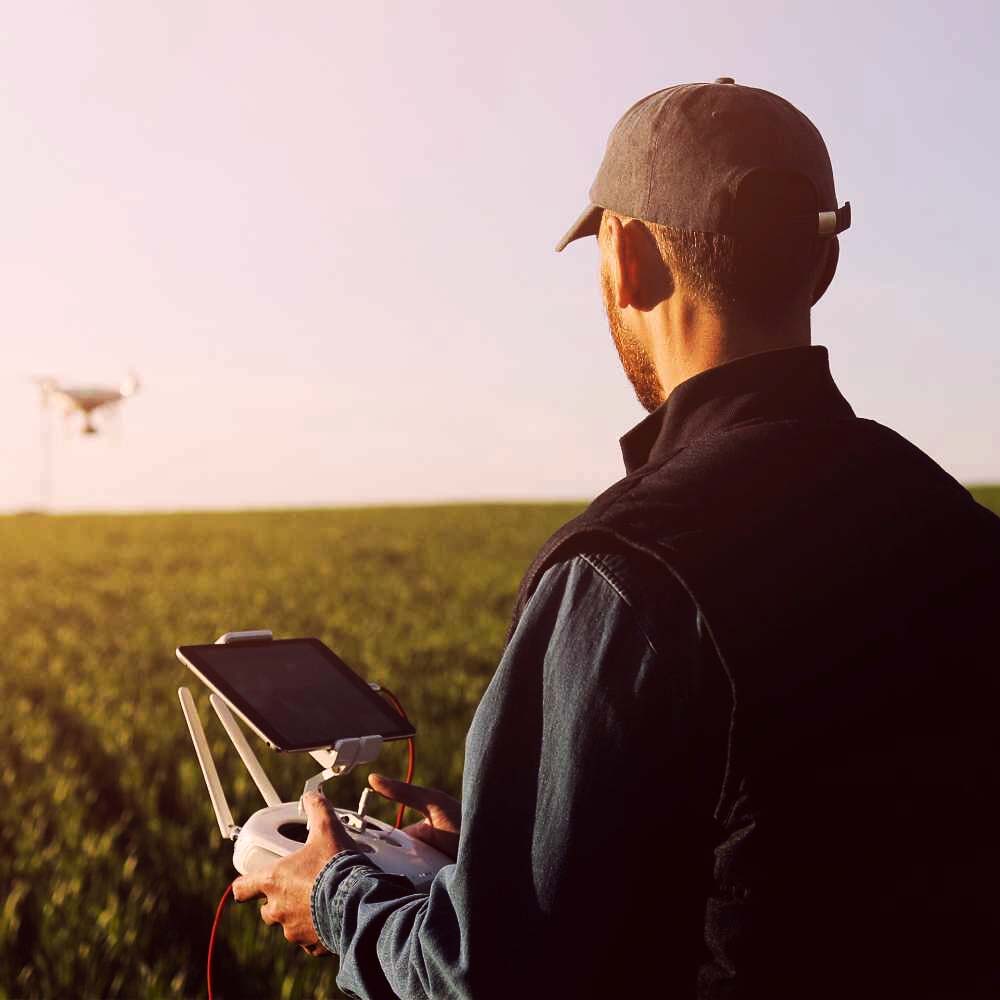
  • Automatically develop a coverage path plan
  • High resolution pictures taken from the CERBERUS UAV
  • Joint interpretation of satellite data
environment-new

Environment

Collection and observation of multidimensional data in ecological environments, using CERBERUS and DIOPTRA prototypes for large-area inspection of environmental infractions.

Multispectral remote sensing for soil and water quality assessment.

forestry_new_bg

Forestry

Application of ACCELIGENCE UAVs in wildfire management and key forest ecosystem attributes characterization:
  • F1T tethered to Elistair station for 24/7 inspection of blind areas and hotspot detection
  • UAV drone seeding system embedded to CERBERUS
  • CERBERUS and SAITA used for LIDAR and hyperspectral imagery acquisition and interpretation
security new

Security

Airborne Object Recognition and Intrusion Detection.

CERBERUS supports both Maritime and overland missions.

agriculture-new

Agriculture

  • Automatically develop a coverage path plan
  • High resolution pictures taken from the CERBERUS UAV
  • Joint interpretation of satellite data
environment-new

Environment

Collection and observation of multidimensional data in ecological environments, using CERBERUS and DIOPTRA prototypes for large-area inspection of environmental infractions.

Multispectral remote sensing for soil and water quality assessment.

forestry_new_bg

Forestry

Application of ACCELIGENCE UAVs in wildfire management and key forest ecosystem attributes characterization:

  • F1T tethered to Elistair station for 24/7 inspection of blind areas and hotspot detection
  • UAV drone seeding system embedded to CERBERUS
  • CERBERUS and SAITA used for LIDAR and hyperspectral imagery acquisition and interpretation
security new

Security

Airborne Object Recognition and Intrusion Detection.

CERBERUS supports both Maritime and overland missions.

agriculture-new

Agriculture

  • Automatically develop a coverage path plan
  • High resolution pictures taken from the CERBERUS UAV
  • Joint interpretation of satellite data
environment-new

Environment

Collection and observation of multidimensional data in ecological environments, using CERBERUS and DIOPTRA prototypes for large-area inspection of environmental infractions.

Multispectral remote sensing for soil and water quality assessment.

Our Products

carbon-background

CERBERUS

- 30' Max. Flight Time (No Payload)

- 5kg Max. Payload

- Carbon Fiber Structure & Cover

- Various Payloads

- RTK GNSS

- Precision Automated Take Off/Landing

- Dimensions: 1.67m. Diameter (incl. propellers)

Versatile UAV platform with on-board AI capability

read more
cerberus-last
carbon-background

FIT

- Theoretically Unlimited Flight Time

- 100m. Max. Flight Altitude

- Carbon Fiber Structure & Cover

- 1kg Max. Payload

- Emergency Backup Battery

- RTK GNSS

- Precision Automated Take-Off/Landing

Tethered surveillance UAV with theoretically unlimited flight time
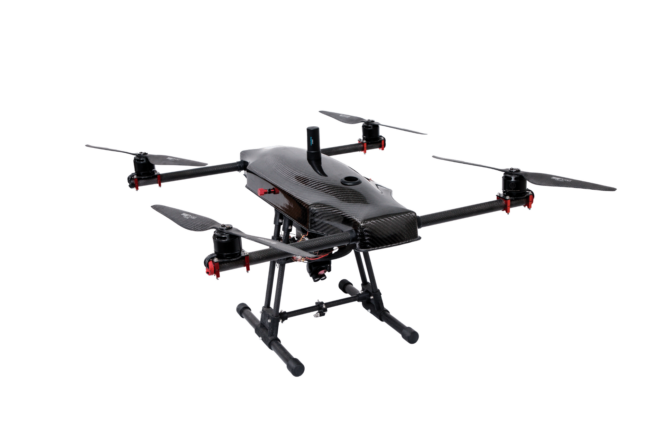
- Dimenions: 0,91m.x0,91m.x0,91m. (LxWxH - incl. propellers)

read more
F1T-last
carbon-background

DIOPTRA

- 16m/s Cruising Speed

- 120m. Typical Flight Altitude

- 60min. Estimated Flight Time

- Up to 340gr. Camera Payload

- FPV Flight with Analogue Camera on-board

- RTK GNSS

- Precision Automated Take-Off/Landing (VTOL)

Fixed wing VTOL UAV for increased range and flight time
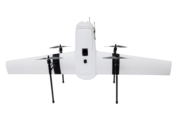
- One-Button Return to Home Function

- 1,45m. Wing Span

read more
DIOPTRA-last
carbon-background

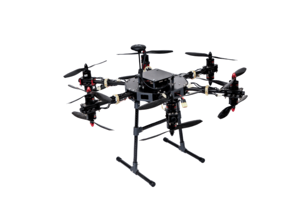
SAITA

- 18min. Max. Flight Time (no payload)

- 400gr. Max. Payload

- Carbon Fiber Structure

- 12 Propellers for Increased Stability & Reliability

- Precision Automated Take-off/Landing

- Dimensions: 0.69m. Diameter (incl. propellers)

12-rotor UAV for increased stability and reliability
read more
SAITA-last
carbon-background

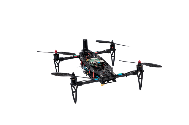
DUMMY

- 3D Printed Low Cost Body & Landing Gear

- 22min. Max Flight Time (no payload)

- Carbon Fiber Arms

- Max. Payload: 0,2kg

- 18min. Average Flight Time (with payload)

- Precision Automated Take-off/Landing

Inexpensive test platform UAV

- Dimensions: 0,51m. x 0,51m.

read more
DUMMY-last
Acceli-icon-BLACK

Acceligence Ltd.

Tel CY:

Tel GR:

Tel UK: